
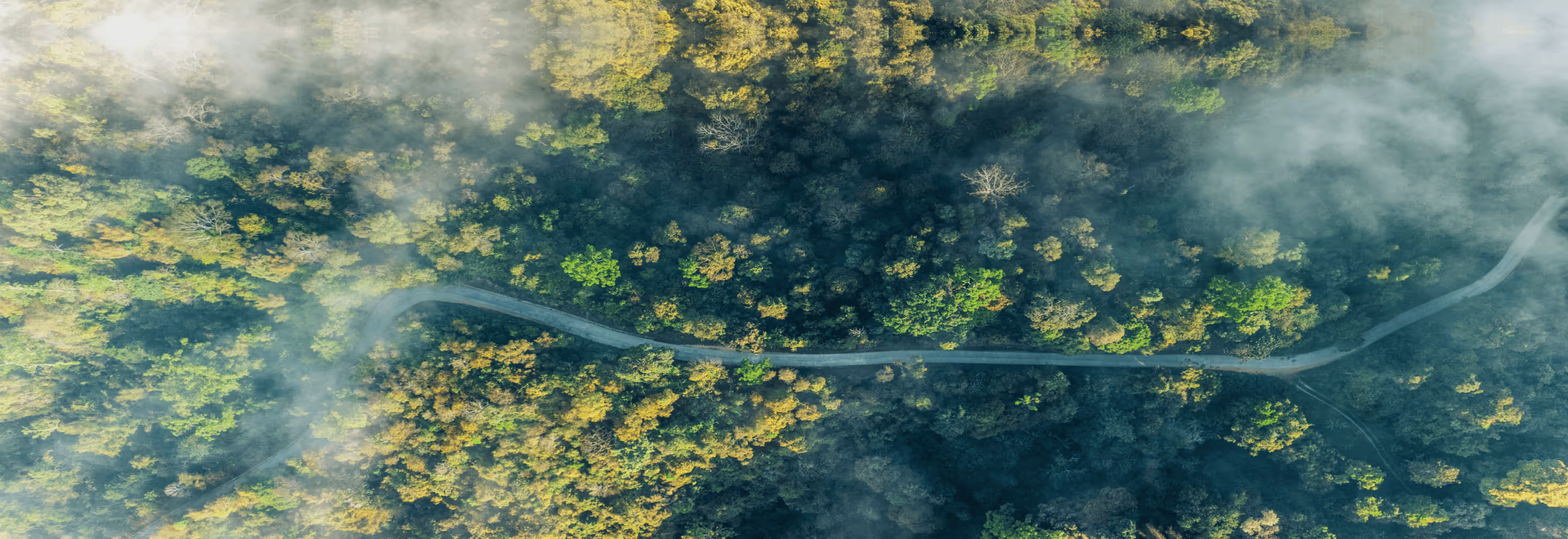
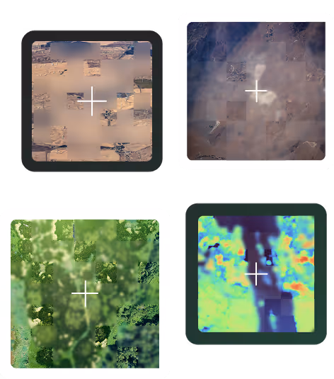
Mitigate Deforestation, Vegetation & Pipeline Risks With Satellite-Powered Precision
LiveEO delivers AI-powered Earth Observation insights that help organizations stay ahead of critical risks. From vegetation encroachment to third-party activity and deforestation exposure, we provide timely intelligence that accelerates response, lowers costs, and enables compliance at scale.
Explore Our Product Suite
Three specialized solutions, built on one satellite-AI foundation, that give teams the visibility they need to act with confidence.

Meet EUDR with Confidence
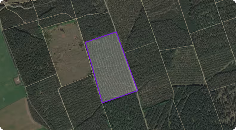
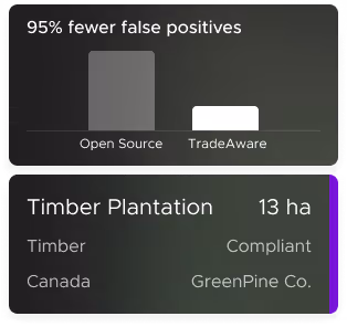
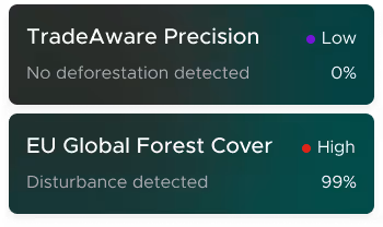
TradeAware helps procurement and compliance teams detect deforestation risk, collect supplier data, and stay audit-ready using satellite imagery, AI, and automation to simplify EUDR compliance. It’s a scalable, risk-averse solution built for operational excellence.
Revolutionize Vegetation Management to Protect Your Grid
Detect grow-in, fall-in, and vitality risks at scale using AI-powered satellite insights. Optimize pruning cycles, reduce outages, and enhance community safety while saving millions through smarter vegetation planning.
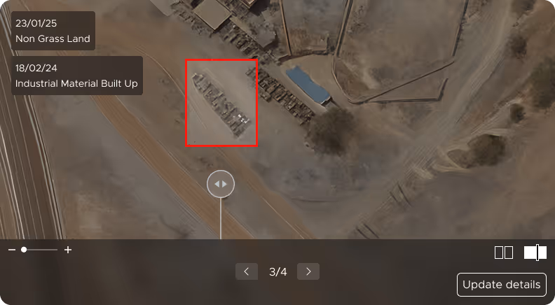
Detect Third-Party Pipeline Threats Before They Escalate
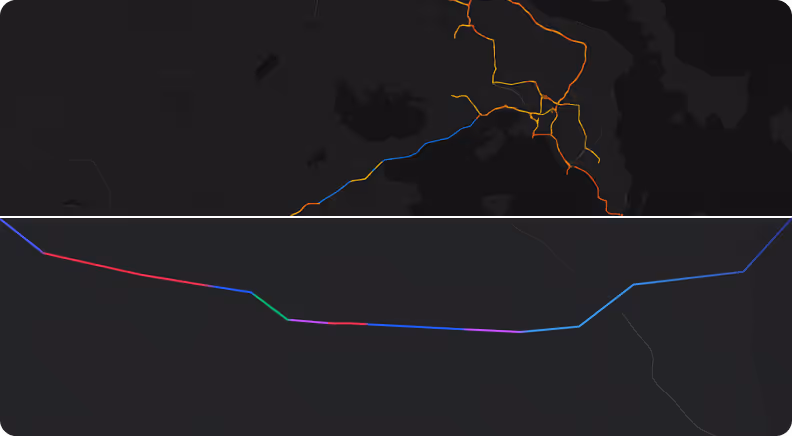
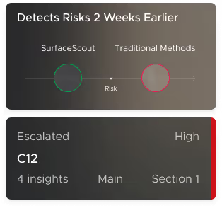
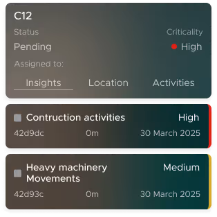
Monitor construction, excavation, and ground movement across your pipeline network with AI-powered satellite insights. Gain wide-area visibility in any conditions, detect 4× more risks, cut inspection costs, and protect corridor integrity at scale.

Trusted by Leaders Worldwide


How We Turn Space Data Into Ground-Level Decisions
By analyzing remote sensing and operational data with AI, LiveEO uncovers critical risks, helping teams reduce risk, save money, and move faster.


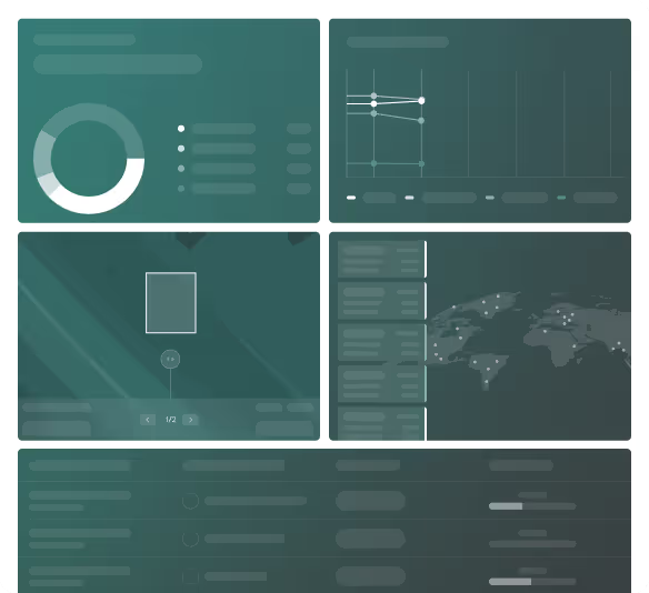
We gather satellite and LiDAR data from partners
We run our complex imagery processing using AI & ML
We generate accurate risk analytics and insights
We deliver you the key insights to out platforms and other softwares via APIs
See How Satellite-Powered Insights Can Change How You Manage Your Assets
Whether you're dealing with vegetation threats, third-party activity near pipelines, or deforestation risk in your supply chain, LiveEO helps you act earlier, with less manual effort.
Chosen by Utilities, Pipeline Operators, and Procurement Teams Across Continents
.avif)
.avif)
.avif)


What Our Customers Are Saying
LiveEO is trusted by industry leaders worldwide.
Here’s what they say about working with us.


“Partnering with LiveEO allows us to establish a platform for gathering information from our suppliers, validating it, storing it, and ultimately sharing it with our customers in a form that is easily submitted to the EU TRACES system. Reaching that decision was a milestone moment in the project.”


"The LiveEO technology gives us a better overview of the vegetation along our tracks. It allows us to address the consequences of climate change even better."


“Westerville Electric went with LiveEO and our outage rate in 2022 was 18%. We are now at 10%. This is the future of vegetation management!”

.avif)
Enterprise-Grade Security That Meets Industry Standards
With SOC 2 Type II certification and in-region infrastructure, we align with your internal policies and external compliance obligations.
FAQs
Curious how LiveEO sources satellite data, applies AI, or integrates into your systems? This section addresses the key things teams typically want to know when evaluating our solutions.


What does LiveEO do?
LiveEO provides AI-powered products that transform satellite data into actionable insights. Our solutions help enterprises monitor and mitigate risks across infrastructure networks and global supply chains, covering vegetation encroachment, third-party pipeline interference, and deforestation exposure.
Who is LiveEO for?
We serve enterprises with complex infrastructure or global supply chains, such as utility providers, oil & gas operators, and commodity buyers, who need scalable, cost-effective ways to manage operational, environmental, and regulatory risks.
How does LiveEO use satellite data?
LiveEO taps into a global network of satellite providers, combining high-resolution and frequent imagery with proprietary AI models. This allows us to detect real-world changes, like tree growth, illegal land use, or construction near pipelines, and translate them into business-ready insights.
What kinds of risks can LiveEO help me detect?
Depending on the product, LiveEO helps identify:Vegetation risks near critical infrastructure (e.g., power lines)Third-party activity or land movement near pipelinesDeforestation and non-compliance across complex supplier networks
Is LiveEO a single platform?
LiveEO offers a suite of tailored products, Treeline, SurfaceScout, and TradeAware, each purpose-built to address specific risk domains while sharing a common satellite-AI foundation.