
Detect Pipeline Risks Before They Happen
SurfaceScout is a software-based, end-to-end pipeline monitoring solution that leverages satellite imagery and AI-powered analytics. It delivers complete corridor coverage, detecting critical changes over time, identifying risks that traditional methods miss up to 73% of the time.
.avif)
Trusted by Leaders Worldwide


Traditional Monitoring Leaves Too Much Unseen
Many pipeline operators rely on field patrols, aerial flyovers, or public reports but these methods often miss emerging risks, waste time on false alarms, and leave teams scrambling when they can’t prove what happened. SurfaceScout is built to solve these gaps.
Threats Go Undetected
Ground inspections and flyovers are limited by weather, altitude, and terrain, leading to blind spots and delayed responses. Consequently, changing scenes and activities such as unauthorized third-party activities (e.g., digging, construction) or natural hazards near pipelines often go undetected.
Too Many Alerts, Not Enough Action
Teams are overwhelmed with unprioritized alerts. Without a system to validate and assign them, critical risks are buried while field staff chase non-issues. The result: inconsistent follow-up and delayed action.
No Single Source of Truth
Even when risks are addressed, evidence is often lost in emails and spreadsheets. This fragmentation makes it hard to show authorities what happened, when, or who was responsible, creating friction during audits and investigations.
Always-On Awareness for Pipeline Operators
SurfaceScout delivers high cadence risk detection across your entire pipeline network using change detection capabilities and high resolution satellite imagery to catch threats faster, reduce false alarms, and ensure a defensible response trail.
Detect Risks Before They Become Incidents
SurfaceScout detects 4X more third-party activities and natural hazards, earlier, by using multi-source satellite imagery and proprietary change-detection AI models, enabling you to act before damage or downtime occurs.
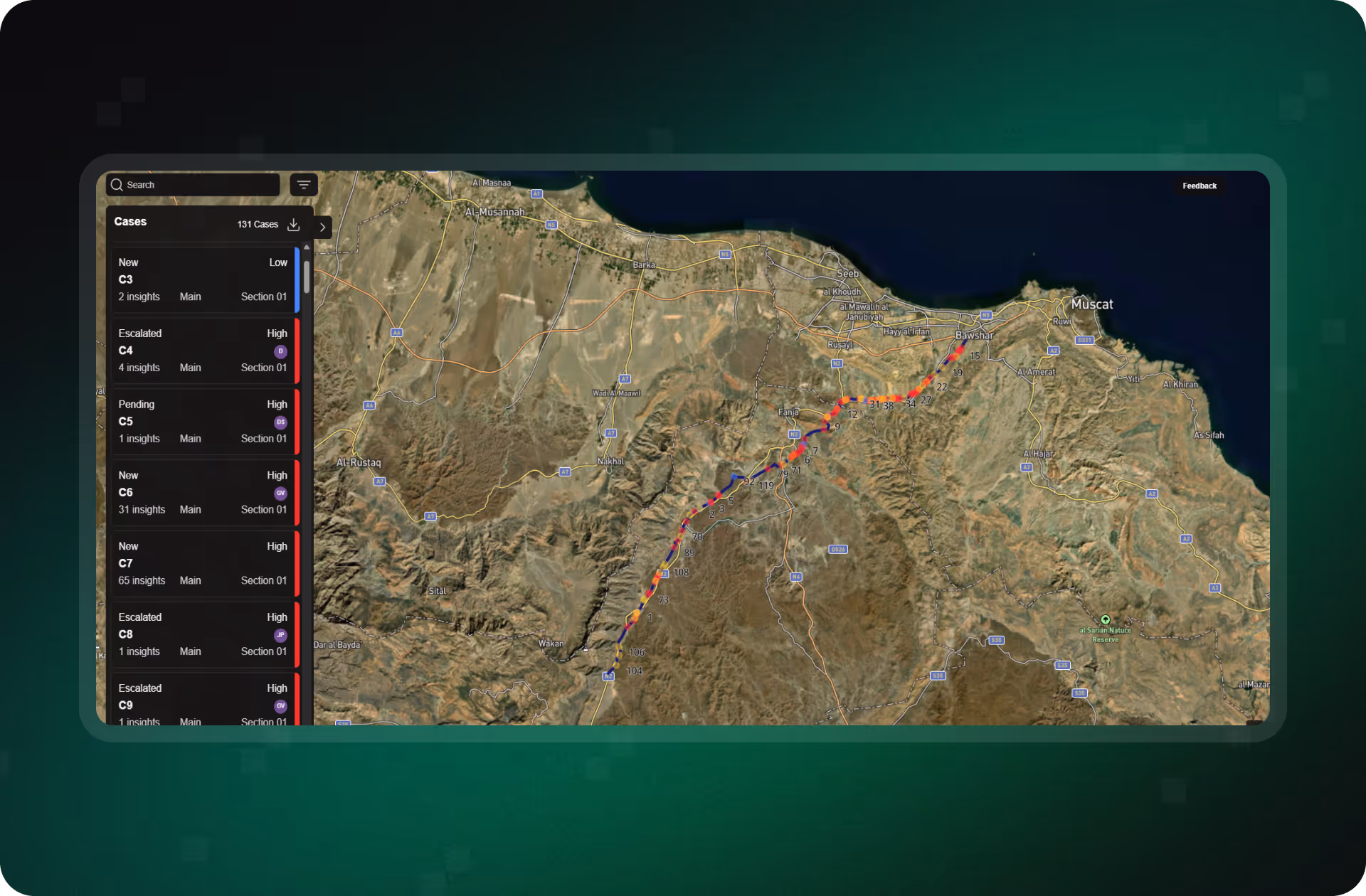
Collaborate Seamlessly on Every Case
Bring all stakeholders together around the Cases highlighted by SurfaceScout. Manage them collaboratively, mitigate associated risks directly from the field, and add notes or photos. In short, unite your team to drive operational efficiency.
Prove It With a Full Digital Audit Trail
Every case is tracked from alert to resolution with searchable timelines, status updates, supporting files, satellite images, built to withstand audits and investigations.
Total Coverage, No Compromise
Monitor 100% of your pipeline, including remote, urban, or restricted areas. SurfaceScout replaces blind spots and expensive flyovers with continuous, automated oversight.

See the Risks. See the Difference.
Get a firsthand look at how SurfaceScout detects real-world threats before they escalate.
Protect Your Pipeline With Continuous Monitoring
Prevent costly disruptions and safety risks with AI-powered visibility across your entire corridor.
How it works
Explore how SurfaceScout closes risk visibility gaps with AI-powered satellite monitoring, automated prioritization, and case tracking, helping pipeline teams act faster, cut costs, and stay audit-ready.
Detect Hazards Before They Become Emergencies
Continuously monitor your entire corridor with satellite imagery and AI. SurfaceScout flags third-party activity and natural hazards early, no flyovers, no blind spots.
.avif)
Turn Insights Into Action
Create and manage cases in one place. Assign tasks, track updates, and collaborate across teams with real-time status changes and field-uploaded photos.
.avif)
Prove Compliance With Defensible Records
SurfaceScout is your damage-prevention data backbone, providing evidence that 100% of your pipeline has been covered with satellite imagery. Every activity is tracked with a complete logging trail, and third-party sources, such as ground patrols, aerial surveys, or drone data, can be seamlessly ingested and linked to cases.
.avif)
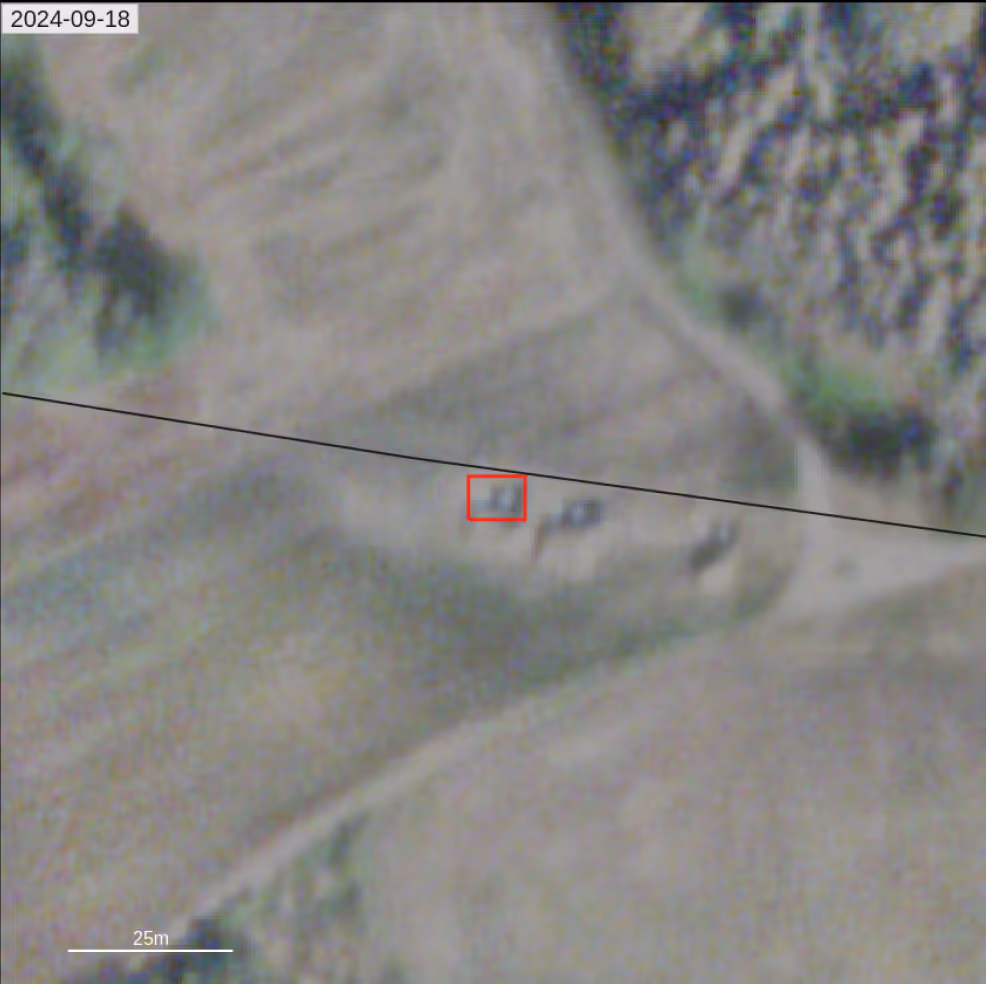
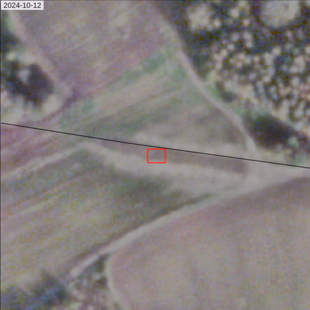
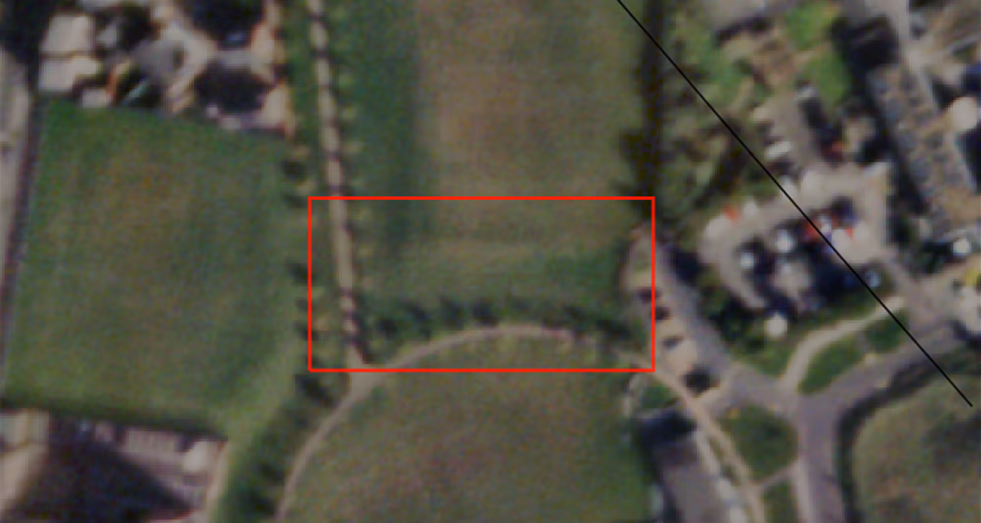
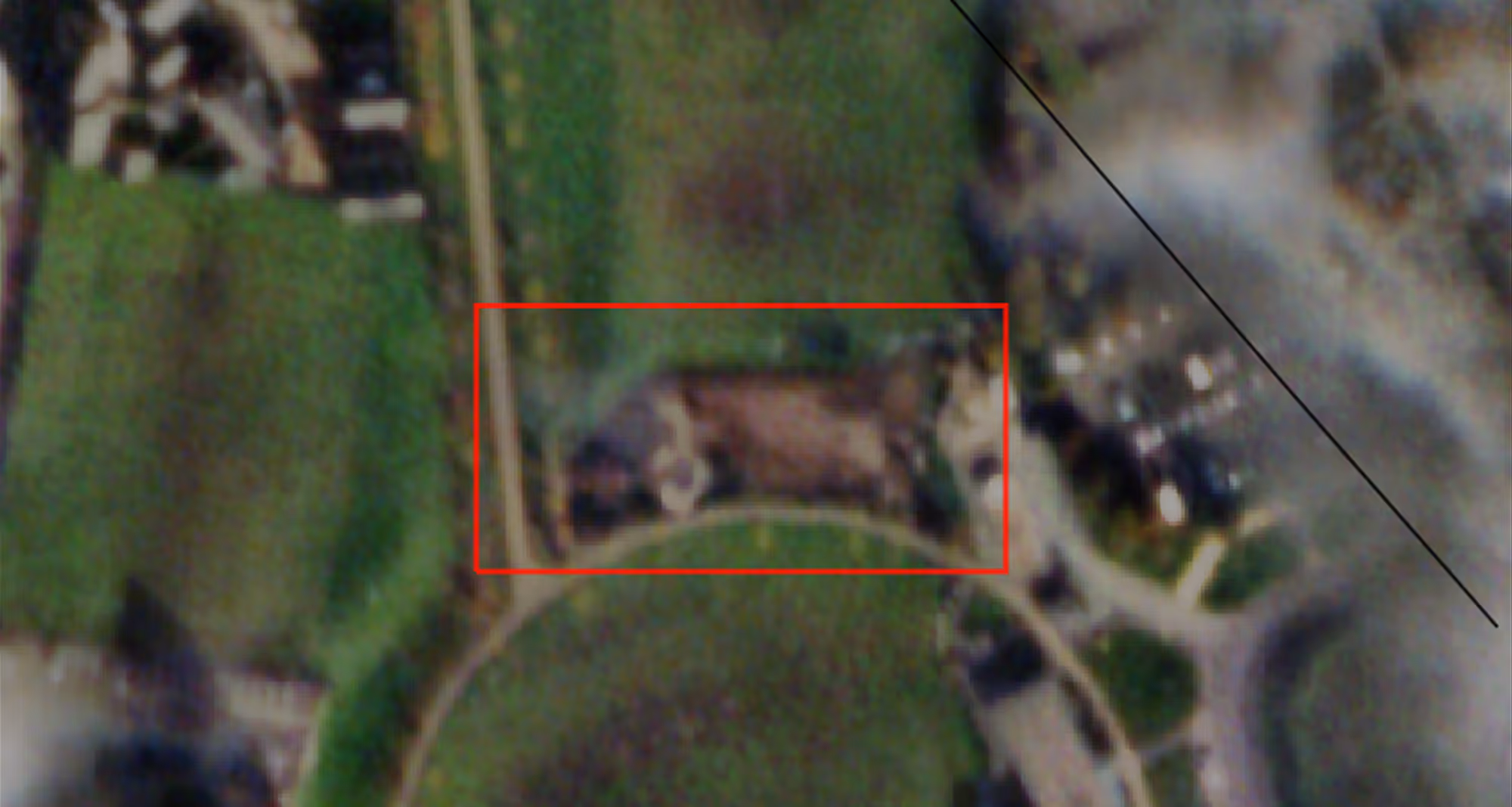
Reveal Hidden Patterns With Time-Sequenced Data
Use time-sequenced satellite imagery to detect gradual threats early. Build visual evidence for inspections and uncover trends patrols might miss.
Scale Monitoring Without Increasing Headcount
SurfaceScout delivers fast, automated insights so your team can act decisively without spending time sorting through raw data.
What You Gain by Deploying SurfaceScout
SurfaceScout delivers value within weeks, not months, by using existing satellite data and AI-driven insights to reduce inspection load, prevent costly failures, and inform smarter capital planning. No field sensors or hardware required.
Swift Start for Your Team
- Managing complex operations can be frictionless. Once we configure the platform to match your change types and risk model, our Customer Success team will guide you through it. From there, the interface is fully self-explanatory, ensuring dozens of team members can start leveraging SurfaceScout in no time. Our team stays there as long as needed to make sure your deployment is a success.
Operational Excellence Through SurfaceScout One Stop Shop Software Solution
- SurfaceScout bridges the gaps between teams and replaces scattered manual operations, insight reviews, case assignments, field feedback via the mobile app, collaboration, and more. No more emails or Excel sheets: SurfaceScout serves as a central platform for damage-prevention visual data, connecting multiple sources such as satellite, ground, aerial, and drone insights.
Proven Risk Reduction in Weeks
- During phase one of your deployment, we work with your team to systematically assess the quality of the insights delivered by our AI-powered satellite analytics. This data-driven approach highlights the uniqueness and relevance of SurfaceScout’s insights. Following the joint assessment, projected reductions in risk exposure typically range from €2M to €10M.
Time-Critical Threats Need Real-Time Response
With insights delivered in under 12 to 24 hours, SurfaceScout helps your team take action before safety or service is impacted.
Why Operators Are Moving Beyond Manual Patrols
Legacy inspection methods are slow, expensive, and prone to error. SurfaceScout gives you satellite-powered insights that scale across your entire pipeline corridor, ensuring you detect risks faster and resolve them with confidence.
Other solutions
SurfaceScout

FAQs
Curious how SurfaceScout detects threats, integrates with your tools, or supports audits? This section breaks down the most important answers so your team can move forward with confidence.


What if the weather is cloudy?
Our Synthetic Aperture Radar (SAR) module is designed to penetrate cloud cover and detect binary changes, providing a reliable backup solution during overcast conditions.
What is your turnaround time for delivering inspections?
Typically, we deliver a full report in under 24 hours, and can accelerate it to within 12 hours if needed. Note that while our reporting isn’t live, our analysis of past inspections has shown that we can often detect potential risks up to two weeks before they manifest.
Why should I consider switching to a satellite-based solution if I already have a full aviation department?
Our customers often combine both aviation and satellite-based solutions to better mitigate risks around pipelines, following the Swiss Cheese Risk model approach. This integrated strategy enhances safety by layering different methods. Our satellite-based solution excels in identifying actionable risks, detecting up to four times more real threats than traditional methods, which significantly reduces risk exposure, saving an estimated €0.5 million. Unlike aircraft inspections, which are limited to specific photo captures, satellite monitoring provides comprehensive coverage of entire areas, improving traceability. Additionally, our fully digital, software-based approach simplifies workflows and enables inspections in regulated zones, like large airports, where aircraft inspections may be restricted. And since it doesn’t require pilots, there’s no risk to them during the process.
Will satellite inspections replace aerial inspections?
It depends on your operational needs. Some of our clients have transitioned fully to our satellite-based monitoring for pipeline integrity and risk management, appreciating its scalability and frequency. Others prefer to blend our satellite insights with traditional methods like aerial inspections to create a more comprehensive monitoring system. The right choice really depends on your infrastructure, objectives, and the level of risk you're managing. SurfaceScout is designed to complement existing processes, or work as a standalone solution, whichever best supports your goals.